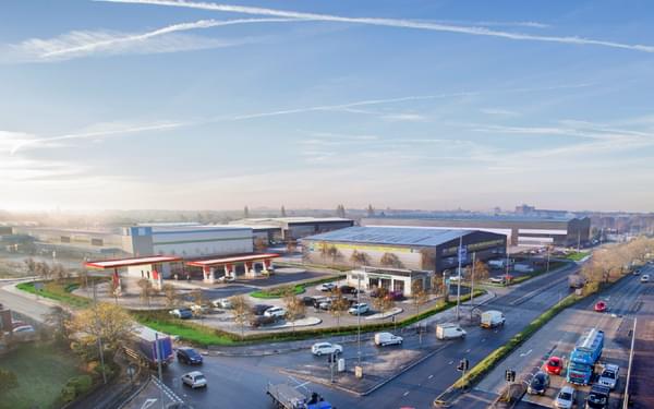
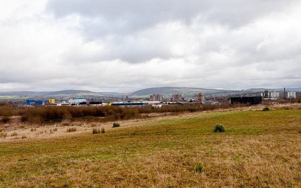
Creating a safer, more sustainable commute in Merseyside

Real-time modelling of the transport network plus detailed design of a CYCLOPS junction and seven miles of cycleways. A solution to improve multi-modal connectivity and enable the community of St Helens to embrace a healthier and more sustainable way of traveling.
Our transport planning and civil engineering teams worked alongside quantity surveying and project management specialists, Pick Everard, via Perfect Circle on St Helens Borough Council’s (SHBC) Southern Gateway Highways Scheme which will provide better connectivity to Lea Green rail station and encourage active travel.
Understanding how people move around in urban environments is key to SHBC’s vision to create more accessible, attractive and environmentally-friendly business and residential communities. This includes looking closely at public transport links within the Liverpool City Region and sustainable methods of commuting, which have a knock-on effect on employment and housing opportunities.
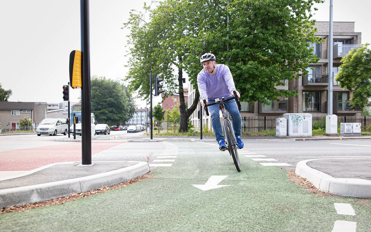
Encouraging active travel and healthier lifestyles
Having been awarded Transforming Cities Fund support from Liverpool City Region Combined Authority, SHBC plans to introduce a network of connected cycling and walking routes to encourage local residents to embrace a healthier lifestyle as part of a wider strategy that links in to building an attractive transport hub at Lea Green.
The by-product of the scheme is that it will serve as a critical piece of infrastructure linking existing and future residential areas, businesses and communities, both to each other and Lea Green rail station.
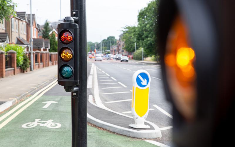
The Merseyside region's first CYCLOPS junction
Concept designs have been drawn up for a network of cycle routes equating to almost seven miles of cycleways and a Cycle Optimised Protected Signals (CYCLOPS) junction ‒which gives priority to cyclists and pedestrians. These will provide better connectivity to Lea Green rail station from surrounding residential areas across the region and are designed in line with objectives set by the Liverpool City Region Local Cycling and Walking Infrastructure Plan.
Providing a second opinion, Pick Everard and our team reviewed initial plans to connect the Southern Gateway scheme into new cycle routes along the A570 Linkway. This included our recommending adjustments that significantly enhance the overall scheme and encourage people to get on their bike, including:
- Moving the proposed cycle routes away from busy roads in favour of safer and more desirable routes, for example through parks
- Introducing new crossings that prioritise cyclists and pedestrians
- Introducing new signage and k-barriers
To enable this approach, and to overcome any knock-on implications, we guided SHBC on the following key areas:
- Reviewing adopted highway boundary plans
- Relocation of bus stops, signage and lampposts to accommodate the proposals
- Consideration of impacts on highway maintenance and drainage
Working to the new cycle guidance, ‘Cycle Infrastructure Design [CID] – Local Transport Note [LTN] 1/20 – July 20’, we’ve advocated using hot rolled asphalt and coloured chippings to segregate the cycle and pedestrian paths from the carriageway, raising both above the level for vehicles. This distinguishes the cycleways from the roads and improves safety.
Cutting-edge transport modelling
We used cutting-edge 3D VISSIM software and MESO modelling to develop a multi-modal microsimulation model of the proposed CYCLOPS junction at the heart of the Southern Gateway scheme. This demonstrates the resulting impact of changes to the highway network by simulating traffic flow and volumes, reflecting the build-up of queues and the probability of vehicles making a left or right-hand turn. For non-technical stakeholders, this visualisation is especially powerful.
Using real-time data, the value of VISSIM is felt over the length of a construction programme because it prevents any costly oversights and time-consuming delays. Applied to the CYCLOPS junction within the scheme, we unearthed a number of issues with the original design proposals, including:
- Likelihood of significant queues, aggravating drivers and causing issues on adjacent junctions
- Conflicts within junctions and on pedestrian and cycle crossings, causing safety issues
This provided the evidence to reassess the original plans and draw up new proposals, which have also been simulated in VISSIM to demonstrate their viability.
To help overcome the limited current traffic data available and changed behaviours as a result of the pandemic, the project team purchased traffic data from 2019 and compared it to data from earlier in the decade to validate the most recent traffic movements available.
To model an increase of cyclists, and pedestrians, we applied a progressive growth factor taking into account the local area developments and allocations. Each of these assessments has a ‘conservative’ and an ‘optimistic’ scenario to assess that the junction works, and also provides economic value when usage by cyclists is not as high, for example during heavy rain.
Following detailed consultation with local residents and stakeholders, the Southern Gateway scheme has recently been approved for funding by Liverpool City Region Combined Authority and received committee approval.
The route to success
The Southern Gateway scheme is on course to be a success because the purpose has been clear from the outset – to enable residents to be healthier and more sustainable – and the project team and partners have been clear in identifying the requirements at each stage and used cutting-edge simulation technology to demonstrate viability and eliminate issues early.